The London Underground Map is famous for ignoring the real geography of the city in favour of a simplified diagram showing the lines and their intersections. The map is so prevalent that Londoners and visitors now probably think of the city in terms of the tube map- referring to an area by the name of a station, or thinking of distances in the tube network as well as the real physical distance above ground.
There have been many maps that try to combine the real geography of the city with the simplicity of the official tube map. This is my attempt.
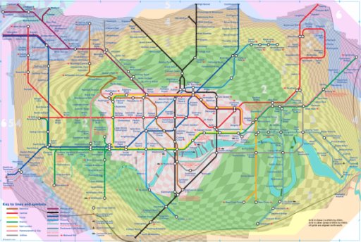
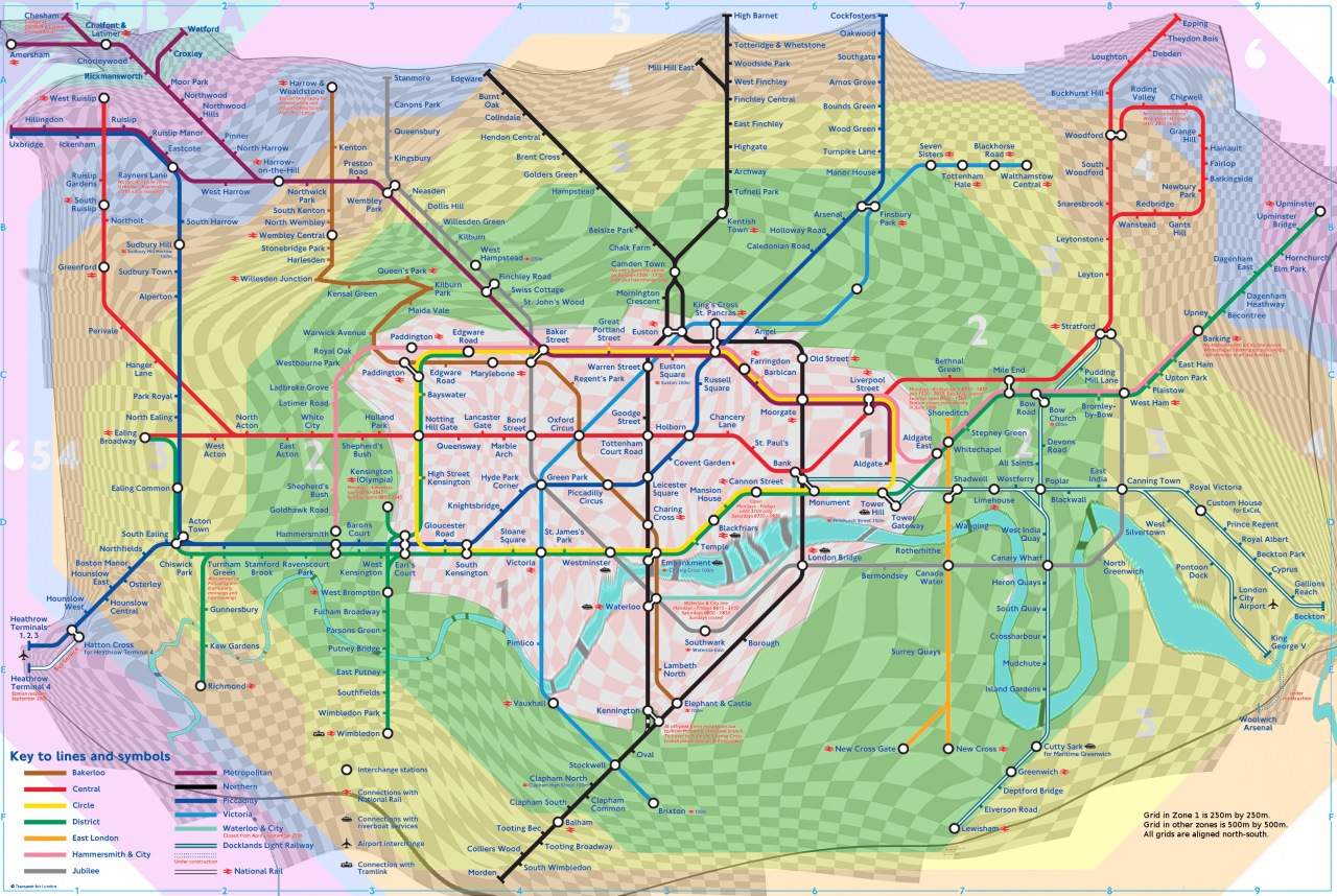
You can see above a version of the official tube map cira 2006. The only real difference is that it has a fine grid that shows how far apart the stations are in real life. It also illustrates what the real directions between the stations are. In Zone 1 (pink), the squares have 250m sides, and in the other zones they have 500m sides. If there are exactly 3 squares between a pair of stations in Zone 3, then they are 1.5km apart. If a grid line runs between two stations, then one is due North (or possibly due East) of the other.
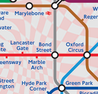
In this close-up, you can see that the distance from Oxford Circus to Bond Street is a bit less than from Bond Street to Marble Arch. By following the line from Oxford Circus you can see that it's almost due north of Green Park; by counting the 250m squares you can see that it's between 750m and 1000m away.
I started with an SVG map of London, showing the real, geographical locations of the tube stations, and added a grid, and the real location of the Thames with its bridges and tunnels.
Using gtkmorph, I marked up the locations of each station on the geographic map and the original London Underground Map. I found that the area around Maida Vale was Too Difficult, so I left it out and ignored the Silverlink railway line.
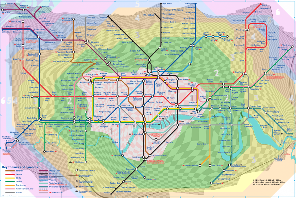
Gtkmorph then produced a warped grid. (Without the above simplifications, it produced a knot at Maida Vale and near Silverton). I put this grid together with the orginal tube map in the Gimp. At this stage, I redrew the section of Bakerloo Line near Maida Vale to match the grid, and airbrushed out Silverlink.
Larger images are available below. Some are Coral-cached, and will be slow to start downloading:
I presented these ideas at Dorkbot London in July 2006 and someone flickred it here..
If you wanna get in touch with me about these maps, you can email me on tubemap at ksglp dot org dot uk .